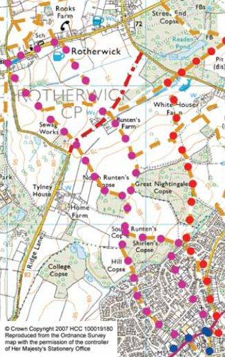
3.5 miles / 5.5km – 1 hour 20 minutes)
This lovely walk is easy for all the family. You’ll often see deer in the fields and in the autumn there are blackberries along many of the hedges.
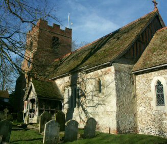
The walk takes you to Rotherwick, with its village duck pond and 13th century church as well as a two country pubs.
| Name / Position / Elevation | Bearing / Distance | Comments |
|---|---|---|
| WP0001 SU 72399 54220 82 m | Head towards Basingstoke from the village centre and take the second on the right down Sheldons Lane. | |
| WP0002 SU 72294 54145 84 m | 235°T 129 m | At the end, take the path and then cross the green and take the footpath next to #37 Middle Mead. |
| WP0003 SU 72049 54325 84 m | 307°T 304 m | Follow this down the hill, across Great Sheldons Coppice and down another path near Goose Green. |
| WP0004 SU 71934 54510 80 m | 328°T 218 m | |
| WP0005 SU 71914 54610 72 m | 349°T 102 m | When it enters the woods, cross the streams and follow the path with the field to your left for about 500m until it comes to an iron gate. |
| WP0006 SU 71939 54705 75 m | 015°T 98.3 m | |
| WP0007 SU 71864 54805 82 m | 323°T 125 m | |
| WP0008 SU 71869 55200 83 m | 001°T 395 m | Take the path to the left and walk around the field for 500m until the field ends. |
| WP0009 SU 71689 55260 81 m | 289°T 190 m | |
| WP0010 SU 71489 55580 79 m | 328°T 377 m | Cross the track and up across the field (you can see Tylney Hall to your left). The path crosses a stile and ends in the left corner of the next field. |
| WP0011 SU 71039 56095 90 m | 319°T 684 m | Turn right at the road. |
| WP0012 SU 71044 56155 89 m | 005°T 60.2 m | Turn right again after about 20m down a bridleway. This passes the duck pond and joins the main street in Rotherwick and passes the church. After about 600m you see the Coach & Horses pub.. (The Falcon pub is 200m down the main street on the left.) |
| WP0013 SU 71384 56320 79 m | 064°T 378 m | Pass four cottages on your right after the pub and then turn right down the footpath. Continue on this path for 600m. |
| WP0014 SU 71724 55785 75 m | 148°T 634 m | Cross the track and carry straight on into the next field. |
| WP0015 SU 71844 55600 78 m | 147°T 221 m | |
| WP0016 SU 71899 55425 82 m | 163°T 184 m | After 650m you go through a stile. |
| WP0017 SU 71864 54925 83 m | 184°T 501 m | After 250m, take the signed footpath to the left where the woods start. Immediately turn right into the woods and follow the path by the edge of the woods (with field on left). |
| WP0018 SU 72019 54880 81 m | 106°T 161 m | |
| WP0019 SU 72234 54850 69 m | 098°T 217 m | Continue until it comes out and crosses a stream. Turn right along Great Sheldons Coppice. |
| WP0020 SU 72194 54750 70 m | 202°T 108 m | Take the first left up Mead Hatchgate. |
| WP0021 SU 72214 54675 75 m | 165°T 77.6 m | Take the path by #8 into Elms Road and then continue back to Hook centre. |
| WP0022 SU 72414 54265 82 m | 154°T 456 m | Hook centre has local shops and three pubs all within two minutes walk: The Raven Hotel, The Old White Hart and the White Hart. |
| Total distance: | 5.6 km |


